
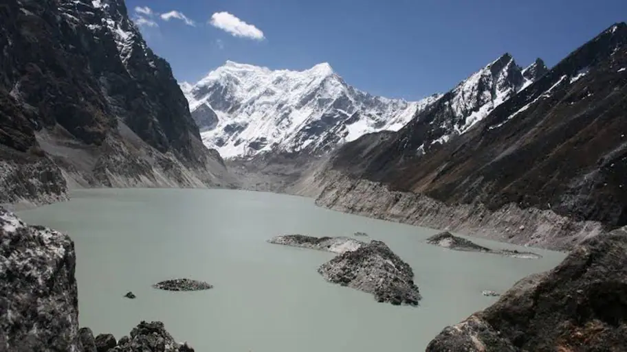
New Delhi: A recent Glacial Lake Outburst Flood (GLOF) near the Nepal-China border has led scientists to assess the risk of similar disasters in India’s Himalayan region.
Dr Dinesh Kumar Aswal, senior scientist and a member of the National Disaster Management Authority (NDMA), said a major glacier collapse or glacial lake outburst in the Indian Himalayas could cause damage on a similar scale or even worse.
From the northeast to the western regions, India has glaciers spread across the Himalayas. A sudden glacier collapse or the bursting of a glacial lake can send huge volumes of water downstream in a short time. Dr Aswal explained that a natural hazard does not automatically become a disaster. The scale of destruction depends on whether people and infrastructure are located in areas exposed to that hazard. Development and land-use decisions can sometimes put permanent settlements in areas where rivers naturally spread during major floods. When a major flood or sudden flow of water arrives, the presence of construction in these areas can increase the damage. Better road connectivity has also led to more settlements in river valleys. Future development plans need to account for the risks in these locations. Scientific mapping of these possible flood levels could help authorities decide where construction should be allowed. Buildings and settlements could be kept above areas identified as vulnerable to extreme flooding. It will reduce the risk from glacier collapses, landslides and sudden floods.
Because large numbers of people were living close to the river, he cited the Nepal disaster as an example, saying the damage was greater. Because water is easily available, population has risen around rivers in many mountain areas. Many of them are located above 5,000 metres and hold large amounts of ice and water. One part of this work, he said, should involve studying the highest water levels recorded by rivers over roughly the past 1,000 years.
He said the country needs to look at where people are living and where roads, buildings and other infrastructure are being built in the Himalayan region. He said glacier and glacial lake monitoring, safer land-use planning, early warning systems and reliable disaster communication need to work together to reduce the risk to people living downstream. “Rivers need their own space,” he said, explaining that natural river channels and flood areas are treated as usable land for homes, roads and towns. He said Himalayan states need a new scientific approach to land-use planning. Dr Aswal said Himalayan states should carry out a detailed assessment of areas that could be affected by extreme floods.
Work on glacial lake monitoring is under way in India. The Hyderabad-based National Remote Sensing Centre (NRSC) has used satellite data to map glacial lakes, while the Central Water Commission (CWC) is also involved in monitoring them. State disaster management authorities are working on similar efforts. In Uttarakhand, the state disaster management authority has assigned the Wadia Institute the task of mapping and monitoring glacial lakes. Himachal Pradesh, Sikkim and Jammu and Kashmir also have their own systems for monitoring risks in the Himalayan region. Scientists need to identify lakes and glaciers that could become unstable and cause a sudden release of water. They need to track how fast a lake is growing and assess the strength of the moraine holding the water back. If a lake increases in size while the moraine weakens can suggest a higher risk. Better data can help authorities detect changes early and issue warnings before water reaches downstream communities. Early warning systems also need to reach more areas across the Himalayan states. Monitoring glaciers and glacial lakes can provide valuable information, but people living downstream need to receive that information fast. Dr Aswal described disaster communication as one of the most important parts of emergency response. During a sudden flood, the time available to warn people can be very short. If information about the approaching danger had reached communities downstream faster, more people may have had time to move to safer areas. The aim should be to ensure that people living downstream receive alerts early enough to act. Each district has a Disaster Emergency Operations Centre under these plans. The next step is to extend a similar system to the block level. The risks facing the Himalayas are changing as glaciers melt, climate-related hazards increase and development spreads into mountain areas.
India has prepared district disaster management plans for around 777 districts, according to Dr Aswal.
Only identifying glacial lakes is not enough, according to Dr Aswal. Such locations need continuous monitoring and more technical systems, Dr Aswal said. Referring to the Nepal disaster, he said the water was moving at a very high speed. India has made progress in this area, he said, but Himalayan states need stronger warning networks and communication systems. The expert said emergency operations facilities at the block level could speed up the flow of information and the local response during a disaster. Dr Aswal said India needs scientific monitoring, safer land-use planning, stronger early warning systems and faster communication to reduce the damage caused by major Himalayan disasters.
