
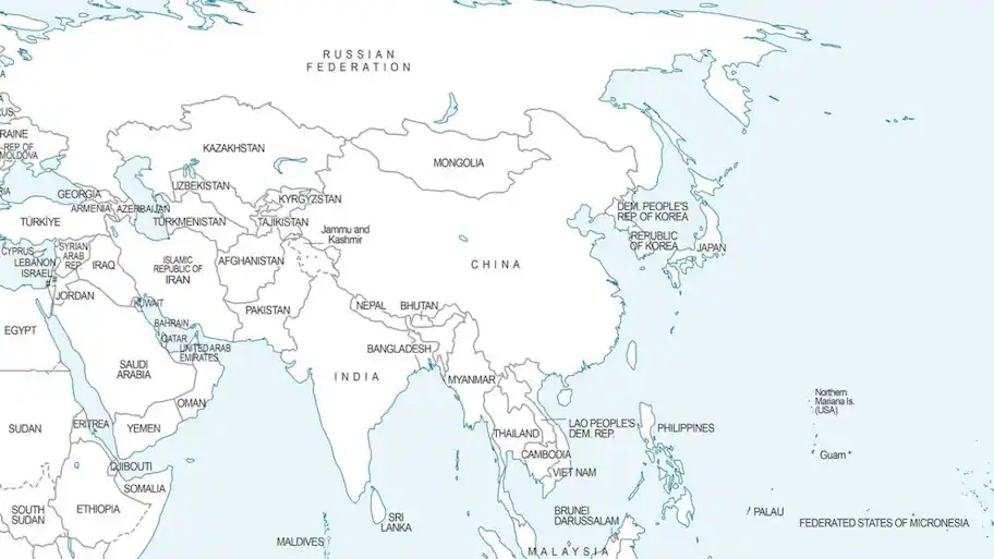
New Delhi: Despite New Delhi supporting the UN resolution under which the map was introduced, a new world map backed by the United Nations has shown Arunachal Pradesh and Aksai Chin as disputed areas between India and China.
Its depiction of parts of India’s territory has faced objections in India. Togo, aaa country in West Africa, presented the proposal on behalf of the African group.
The map was first published on July 1 during the United Nations General Assembly (UNGA) debate on the “Correct the Map” proposal. The UN General Assembly adopted the African Union-backed “Correct the Map” proposal last week.
The proposal is not legally binding. The map is expected to be used by international and multilateral organisations as a standard representation of the world’s regions. India voted in favour of the proposal. The ministry also made clear that the resolution should not be treated as India’s acceptance of any particular map or depiction of national boundaries.
New Delhi said its support was based on the broader principle of ensuring fair representation in geographical mapping, rather than approval of any particular map. The Ministry of External Affairs (MEA) said India’s vote was based on “the fundamental principle of promoting equal-area map representation”. “India’s sovereign territories should be depicted as per India’s official map, including the Union Territories of Jammu & Kashmir and Ladakh,” the ministry said.
