As it moved, the rain spread across several states, causing flooding and forcing evacuations. The Bay of Bengal deep depression hit India’s eastern coast on September 23, bringing heavy rain to Odisha before moving inland towards central and northern India.
The rainfall data shows how strongly the depression affected the state. But it was not the highest departure during the period. Between September 23 and 28, Odisha recorded 457.9 per cent excess rainfall. Uttar Pradesh recorded 543.8 per cent excess rainfall, followed by Chhattisgarh at 498 per cent. Uttarakhand also saw a sharp departure of 399.9 per cent.
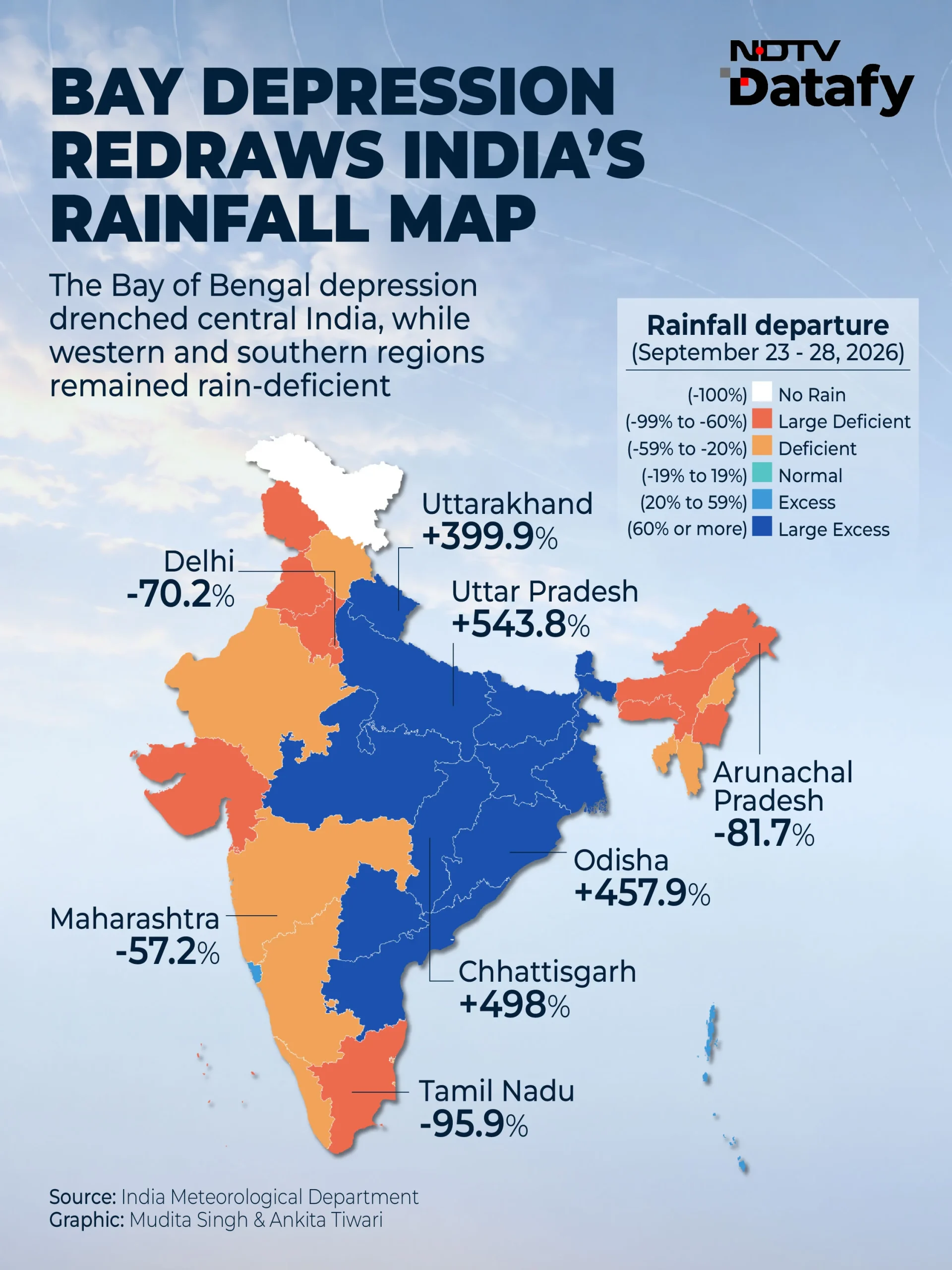
The impact was particularly severe in Uttar Pradesh. Bihar also saw flooding and evacuations as heavy rain affected several districts. But the rainfall was far from uniform. several regions remained severely deficient While the depression dumped large amounts of rain over parts of central and northern India. The effect of the late rain spell was also visible in Delhi’s temperatures.
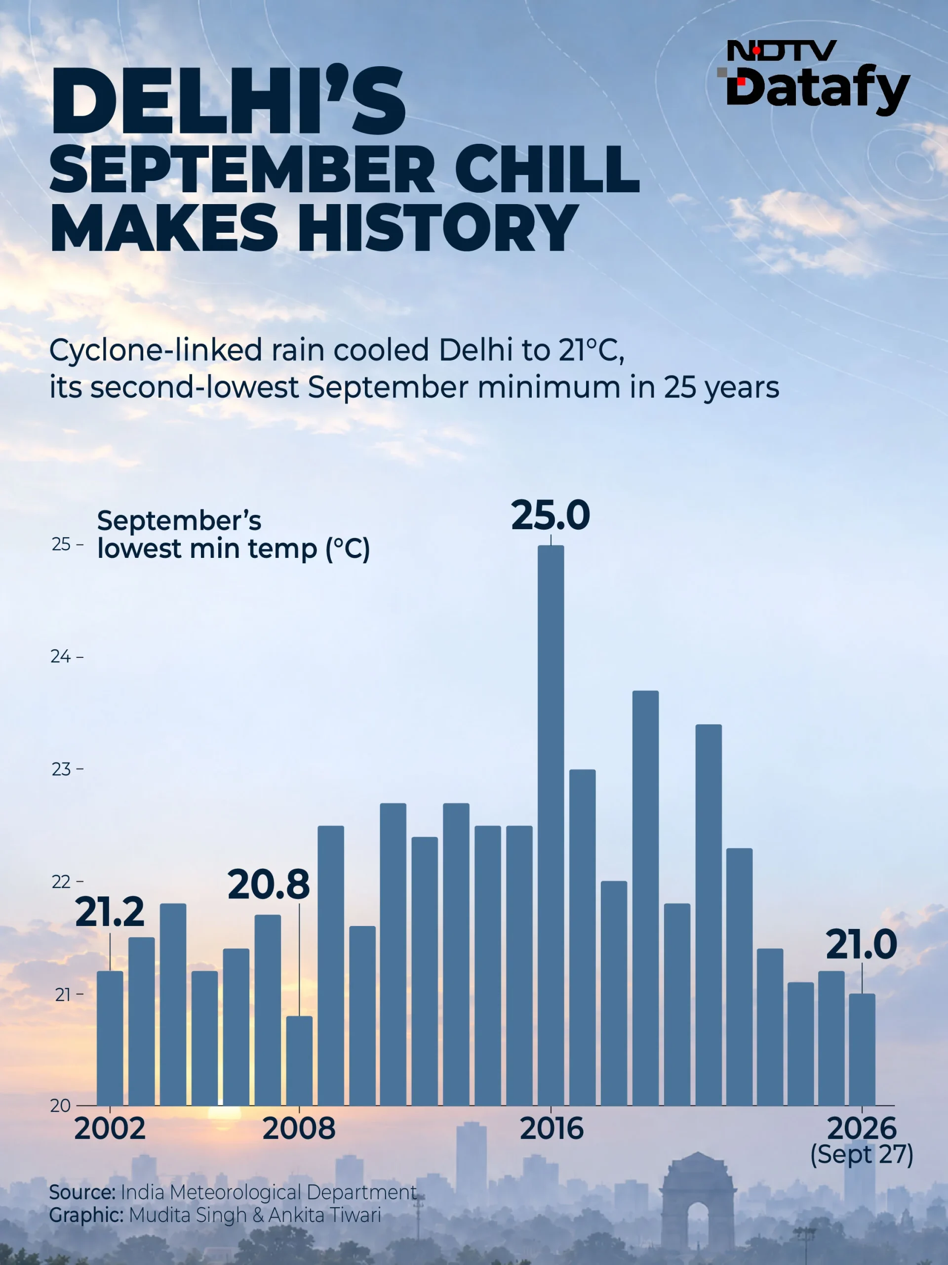
Heavy rain and storms killed 56 people and injured 46, while more than 1,000 houses were damaged. The rainfall departure for the period stood at 101.8 per cent above normal. Haryana recorded an 82.1 per cent rainfall deficit, while Maharashtra recorded a deficit of 57.2 per cent. Maharashtra has declared drought in 74 per cent of the state and around 265 of 358 talukas are affected. The southwest monsoon had withdrawn from the capital on September 23, but rain returned as the depression moved inland. On September 27, the Safdarjung area recorded a minimum temperature of 21 degrees Celsius.