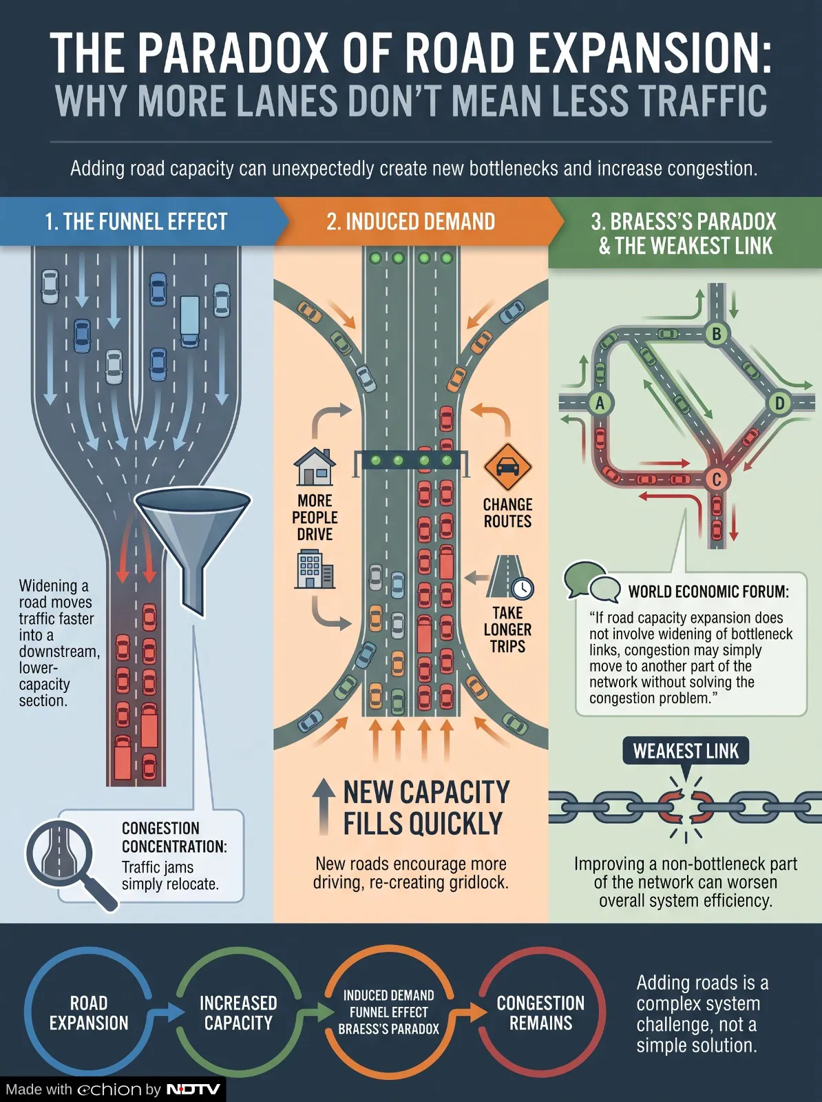
Flyovers and elevated corridors have long served as defining symbols of rapid growth in megacities across the world, including Delhi. These structures are built primarily as a quick response to crippling traffic congestion and provide signal-free paths through high-density urban areas. However, modern urban planning shows that while flyovers provide temporary relief, they often face significant operational limits.
Like the Barapullah Phase-3 flyover that is being slammed for creating a new traffic bottleneck instead of solving the existing problem of congestion.
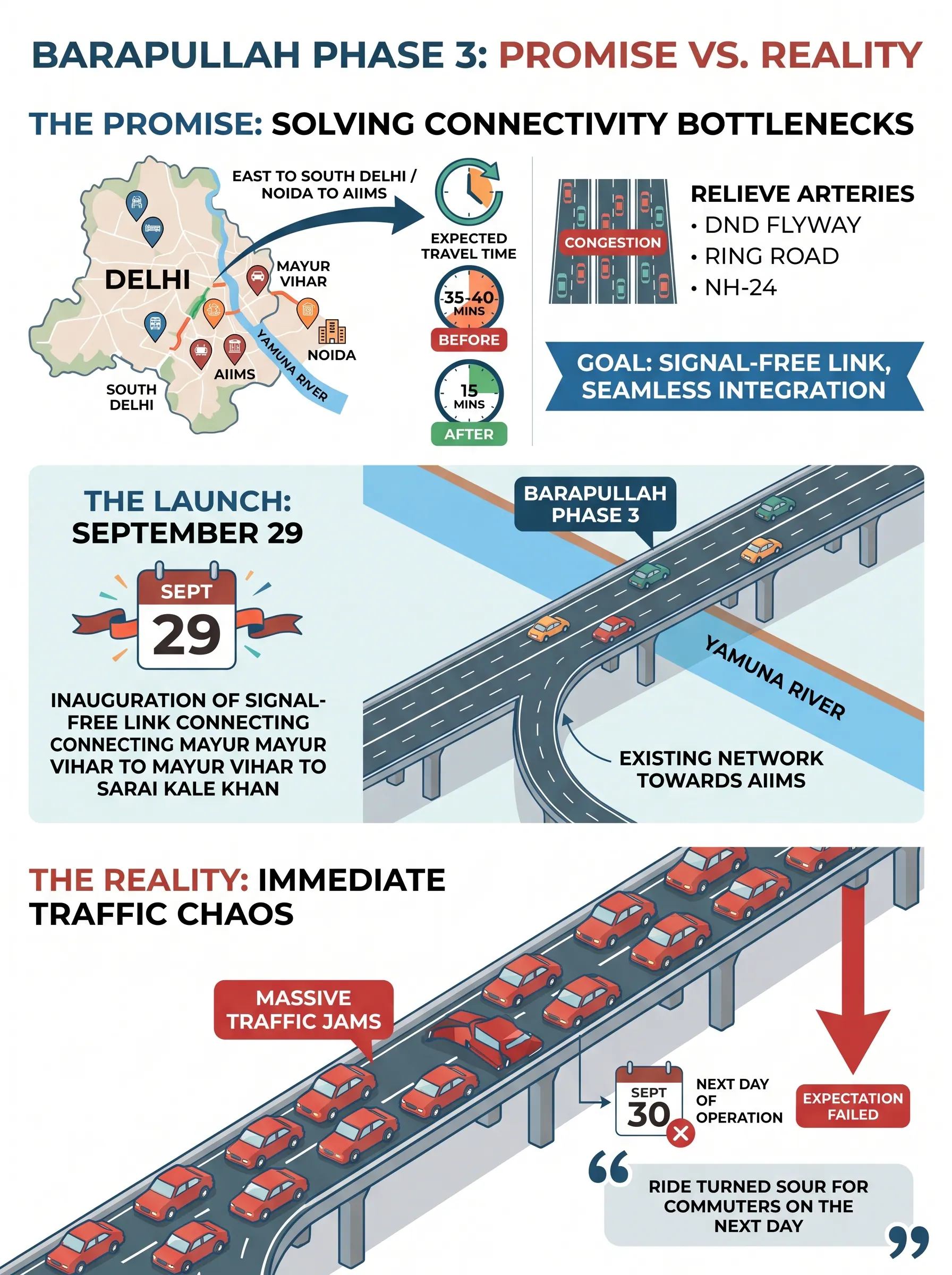
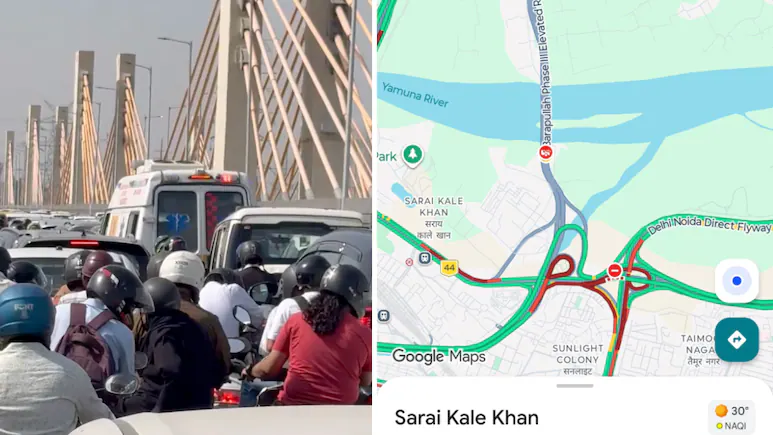
The new corridor brings multiple streams of traffic into the older three-lane section. When commuters started venting their anger on social media, the Delhi Traffic Police responded by blaming Google Maps . “A meeting was held with PWD officials, Delhi Traffic Police and the National Highways Authority of India (NHAI) to figure out if there is scope to restructure any part of the flyover to ease the congestion. But no final decision has been taken yet,” news agency PTI quoted a senior government official as saying.
The Delhi Traffic Police replied to several frustrated users on X saying that around 8-9 lanes were converging into three. It said that the problem is partly that Google Maps is not reflecting the actual traffic situation on Barapullah Phase 3 towards Barapullah and Ring Road. For now, the traffic police is asking commuters to avoid the affected stretch and take alternate routes toward NH-24 and DND.
“This has resulted in heavy traffic volume and a bottleneck at Barapullah Junction, causing congestion to extend for a considerable distance,” the traffic police further said in the tweet.